A fierce heatwave pushing temperatures toward 36°C has triggered emergency wildfire-risk restrictions across parts of Tenerife, announced by the island’s governing body, the Cabildo de Tenerife, and in force since 8am on the Thursday the measures were declared. If you’re driving a rental car around the island right now, the good news is that the ordinary road network — the TF-1, TF-5, TF-21 up to Teide, the coast roads — isn’t affected. What is affected is a specific, mapped set of forest tracks, recreational areas and one well-known viewpoint, and knowing the difference matters if your itinerary includes anything beyond the main tarmac.
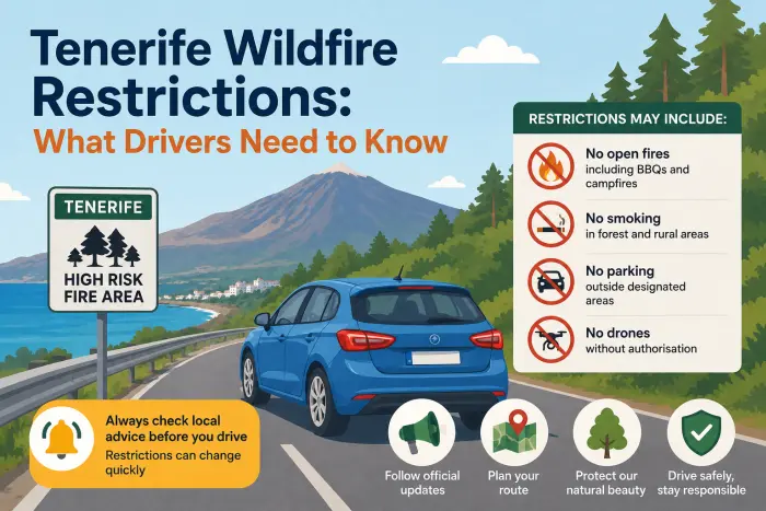
The island has been split into two risk levels, and the restrictions are meaningfully different between them. Getting this wrong isn’t just a matter of missing a nice detour — driving somewhere that’s currently banned during an active fire-risk order is the kind of thing that draws police attention fast, on an island where the memory of the devastating 2023 wildfire, which burned through thousands of hectares and forced village evacuations, is still very much alive locally.
The Two Zones, Plainly
- The main road network — TF-1, TF-5, the TF-21 up to Teide, all the coast roads — is unaffected; this order targets forest tracks and named recreational sites, not tarmac.
- Level 1 (north slopes, North Anaga): no barbecues, stoves, smoking or spark-generating tools in forest recreational areas.
- Level 2 (south slopes, South Anaga): recreational driving on forest tracks is banned outright, and the Chimaque Viewpoint is closed.
- There’s no fixed end date — the order lifts “once the wildfire risk subsides,” which could mean days or weeks depending on the heatwave.
- If you see smoke while driving, don’t head toward it — call 112 with your location and get somewhere safe first.
What exactly is banned right now, and where? 🔥
It depends which of the two zones you’re in. Across the northern slopes of Tenerife and North Anaga (Level 1), the restrictions focus on anything that could spark a fire directly: lighting barbecues, bonfires or any other open flame, using portable gas stoves outdoors, burning agricultural or forestry waste, smoking anywhere in forest recreational areas (including trails, roads and viewpoints within them), operating spark-generating machinery like brush cutters or welding equipment, and any fireworks or pyrotechnics.
Across the southern slopes of Tenerife and South Anaga (Level 2), the rules go further and start to directly affect drivers: recreational driving on forest tracks is banned outright, along with access to affected campsites and recreational sites, sporting events on forest trails, traditional rural pilgrimages (romerías) through forest areas, forestry work, and shotgun hunting island-wide. Access to the Chimaque Viewpoint in the Anaga mountains has been specifically closed under these measures.
| Zone | Areas covered | Key restriction for drivers |
|---|---|---|
| Level 1 | Northern slopes, North Anaga | No open flames, stoves, smoking or spark-generating tools in forest areas — ordinary roads unaffected |
| Level 2 | Southern slopes, South Anaga | Recreational driving on forest tracks banned; Chimaque Viewpoint closed; campsites/recreational sites closed |
Does this affect ordinary road driving, or just forest tracks? 🚗
Just forest tracks and the specifically named recreational/viewpoint access — your regular route to Teide, Masca, the south coast resorts or across to Puerto de la Cruz on the main tarmac roads is unaffected by these particular measures. The distinction that matters is between paved public roads (the TF-numbered network you’d normally use) and unpaved forest tracks used mainly for recreational off-road driving, hiking access, or forestry management — it’s specifically the latter that Level 2 has closed to recreational traffic. If your trip is built around Anaga’s road trip route or the drive up to Teide on the main road, you’re not affected by this specific order — though it’s always worth a quick local check before setting off during any active fire-risk period, since conditions can escalate.
Why has Chimaque Viewpoint specifically been closed? 🌄
Because it sits within the Anaga mountains’ Level 2 zone, where the fire risk is currently judged highest, and viewpoints with forest access on the approach are exactly the kind of location authorities close first — high footfall, dry vegetation right up to the parking area, and limited vehicle access if an evacuation became necessary. If Chimaque was on your list, it’s worth having a backup from our roundup of the island’s best miradors — plenty of coastal and lower-altitude viewpoints outside the currently restricted zones offer comparable views without the closure risk.
How long will these restrictions stay in place? ⏳
Officially, “until the wildfire risk subsides” — there’s no fixed end date built into the order, which is standard for this kind of emergency measure and means it could lift within days once temperatures ease, or extend for longer if the heatwave persists. AEMET, Spain’s meteorological agency, had forecast temperatures reaching the low-to-mid 30s across large parts of the island, with some eastern, southern and western areas potentially hitting 35–36°C, alongside overnight lows staying unusually high. Practically, that means checking the current status the same day you’re planning to head into an affected area is worth doing, rather than relying on what you read here or anywhere else being current by the time you travel — these orders move with the weather.
What should you do if you’re already driving and see smoke? 🚨
Stop trying to get a closer look and instead call Spain’s emergency coordination number, 112, with as accurate a location as you can give — a nearby town, a kilometre marker, or GPS coordinates from your phone if you have signal. Don’t attempt to drive toward or through visible smoke to reach a planned destination; visibility and wind direction can change fast in a live fire situation, and mountain roads with narrow shoulders and no easy turning points are a genuinely dangerous place to be caught out. If you’re in a rental car, the same rule that applies to any breakdown or emergency situation applies here too — get yourself somewhere safe first, then deal with logistics.
🚗 Discover Tenerife – Best Car Rental Deals
Compare top-rated suppliers, no hidden fees & free cancellation included.
Does this affect where you can park or picnic during your trip? 🧺
Yes, specifically in the affected zones — recreational sites and campsites within the Level 2 area are closed as part of the same order, and open-flame activity (barbecues, portable stoves) is banned across both zones’ forest recreational areas, not just Level 2. This is worth knowing if a barbecue picnic spot in the hills was part of your plan, since it’s exactly the kind of activity these measures are designed to stop first. Coastal picnic areas and beach-adjacent spots, well away from forest vegetation, aren’t part of this particular restriction.
How is this different from a calima day or a storm closure? 🌫️
Three genuinely separate hazards, and it’s worth not conflating them even though Tenerife can occasionally serve up more than one at once — as it has this week, with calima expected to add to the discomfort of the heatwave. Calima is Saharan dust reducing visibility and air quality, a driving-conditions issue rather than an access restriction — the roads stay open, you just drive more cautiously and expect hazier views. A severe weather closure is typically wind- or rain-driven, closing specific roads or the national park outright under an official PEIN emergency declaration. This wildfire-risk order is heat- and dryness-driven, zone-based rather than road-based, and focused on preventing ignition rather than responding to poor visibility or storm damage. All three can technically restrict where you go on any given day, but the trigger, the geography and what’s actually banned are different each time.
FAQ
Is it safe to drive to Mount Teide right now given the wildfire risk warnings? Yes, the main TF-21 road to Teide isn’t part of the current restrictions, which apply specifically to forest tracks and named recreational areas rather than the primary road network.
Can I still visit Anaga during the current fire restrictions? The main road route through Anaga remains open; it’s specifically forest tracks and the Chimaque Viewpoint within the South Anaga Level 2 zone that are currently closed.
What happens if I’m caught driving on a restricted forest track? It’s treated as a breach of an active emergency order and can draw a fine or on-the-spot police intervention — these restrictions are enforced, not just advisory, while they remain in force.
Do these wildfire restrictions affect flights or car hire pickup at the airports? No — both of Tenerife’s airports have continued operating normally throughout past wildfire events on the island, and this current order is specifically about forest and mountain access, not airport operations.
Is barbecuing banned everywhere in Tenerife right now, or just in certain areas? Just in the forest recreational zones covered by the order — open flames, stoves and barbecues in these specific areas are banned across both risk levels, but it’s not an island-wide ban on cooking outdoors generally.
How can I check if a specific area is still under restriction before I drive there? The Cabildo de Tenerife’s official channels and local news sources publish updates as conditions change, and it’s worth a quick check the same day you’re travelling, since these orders lift as soon as the underlying risk eases.
Does smoking count as banned even just while driving through an affected area? Yes, within the forest recreational zones specifically — trails, roads and viewpoints inside those areas are covered by the smoking restriction, not just designated picnic or camping spots.